To those of us who’ve lived in the San Francisco Bay Area for many years, it’s still a shock to drive across the San Francisco-Oakland Bay Bridge since its east span has been reconfigured. Starting last September, instead of driving under an upper deck for its entire length, all of a sudden you emerged into the open air halfway en route to the East Bay. Not only could you see the sky and the water on each side, but there were also pedestrians and bicyclists on the south side, a new path having been constructed for just that purpose.
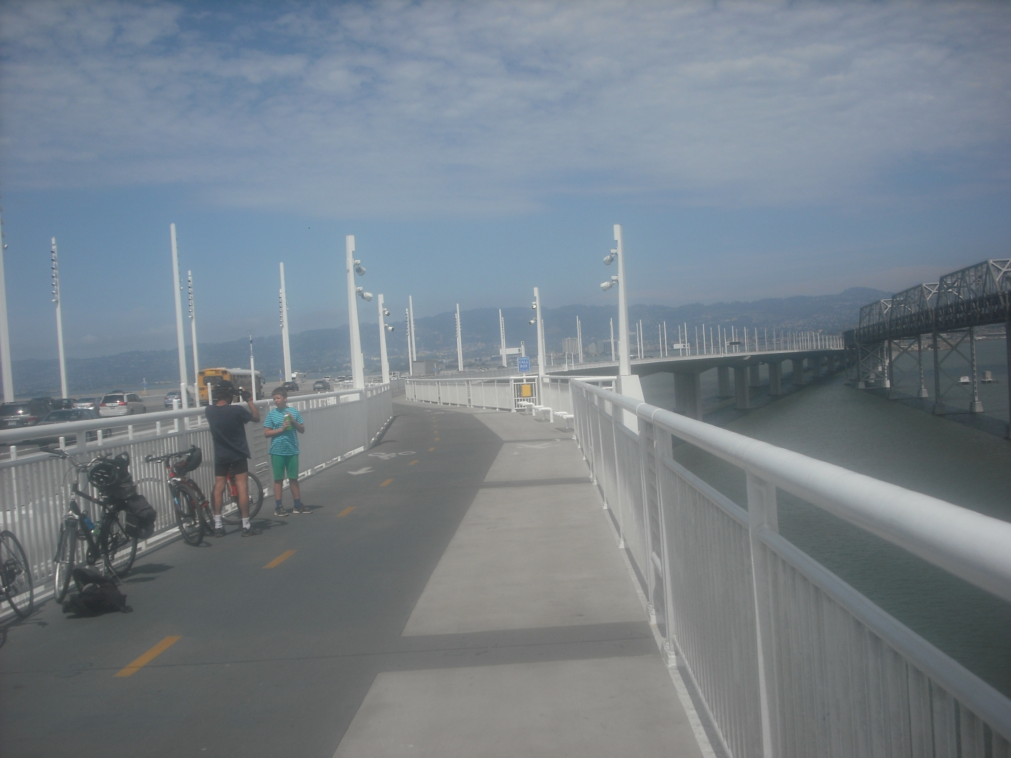
The family-friendly Bay Bridge bike/pedestrian path. Baby strollers and dogs are not uncommon sights either.
It seemed like there was a mini-boom in bikers and walkers right after the path opened, but it seems to have cooled off a little as the novelty’s worn off a bit. I cycled the path ten days or so after it opened in September 2013, but only went back for the second time this week, helping a friend to celebrate her birthday. I didn’t have my blog the first time I rode it, but I do now, so it’s time to make it the subject of a post.
Though it’s well worth doing, know this: the path, especially the two miles or so before you reach the bridge proper, is never going to compete with riding over the Golden Gate Bridge in the glamour sweepstakes. The most convenient entry point is right across the street from the entrance to IKEA in Emeryville; on the way to the bridge ascent, you pass all manner of industrial facilities that, no matter what renovations are in store for the far-off future, seem pretty entrenched for the near future. I’m not sure who will take advantage of a pathside bench we saw in the midst of this quasi-industrial park en route, except if you really need to stop and take a breather.
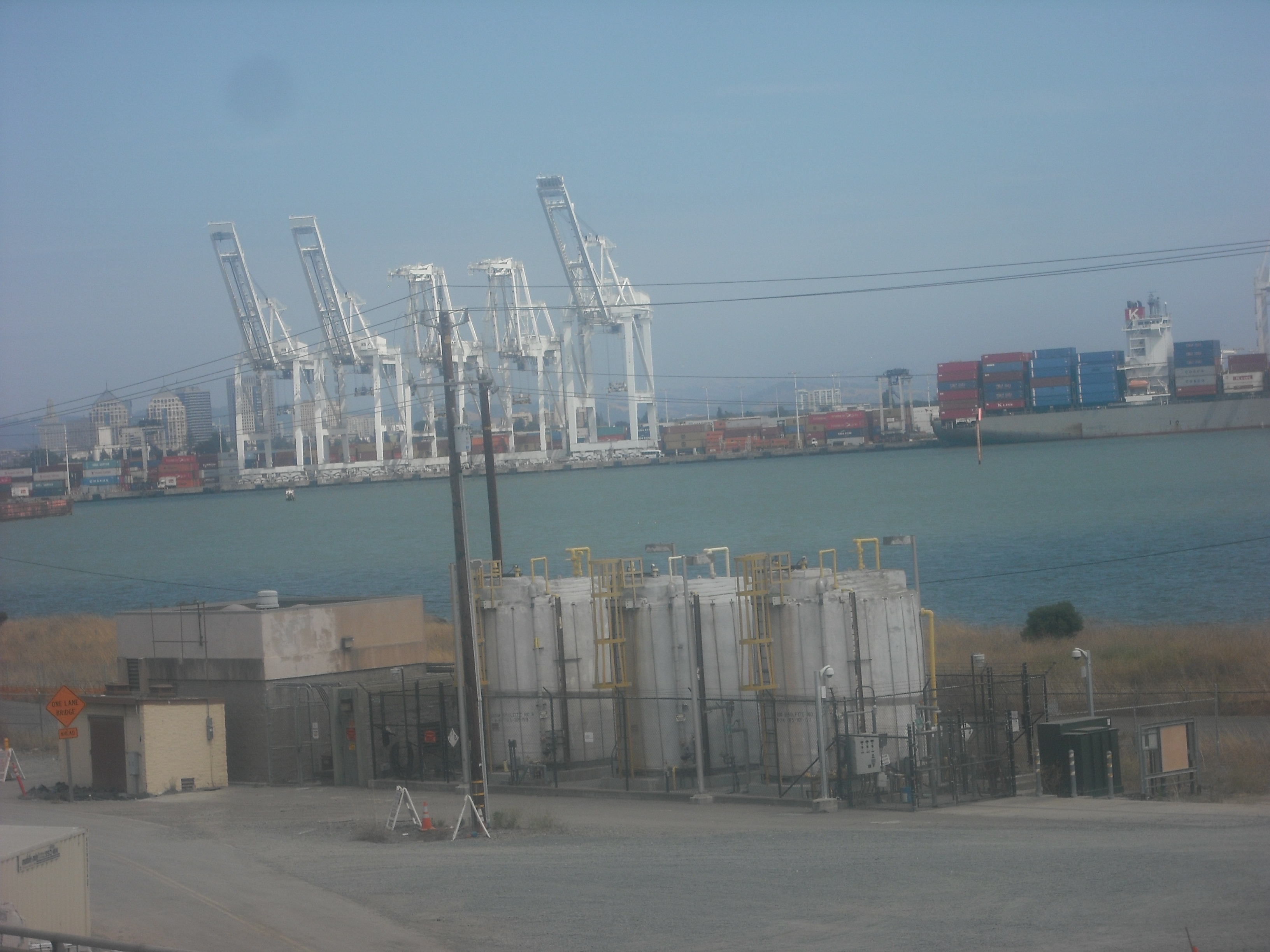
Easily visible from many points on the Bay Bridge (and even on the BART ride from San Francisco to Oakland), these giraffe-like structures are actually among the more aesthetically pleasing features of the industrial area of Oakland near the approach to the bridge.
The oddest sight as you pedal by the water, however, is the yet-to-be-demolished old bridge portion on the south side of the path, standing all by its lonesome with no vehicles or human activity save construction workers. It’s a bridge to nowhere, inhabited only by birds the day we took our ride. Looking at the east “entrance,” such as it is in mid-July 2014, makes you feel like you’re in one of those post-apocalypse horror movies:
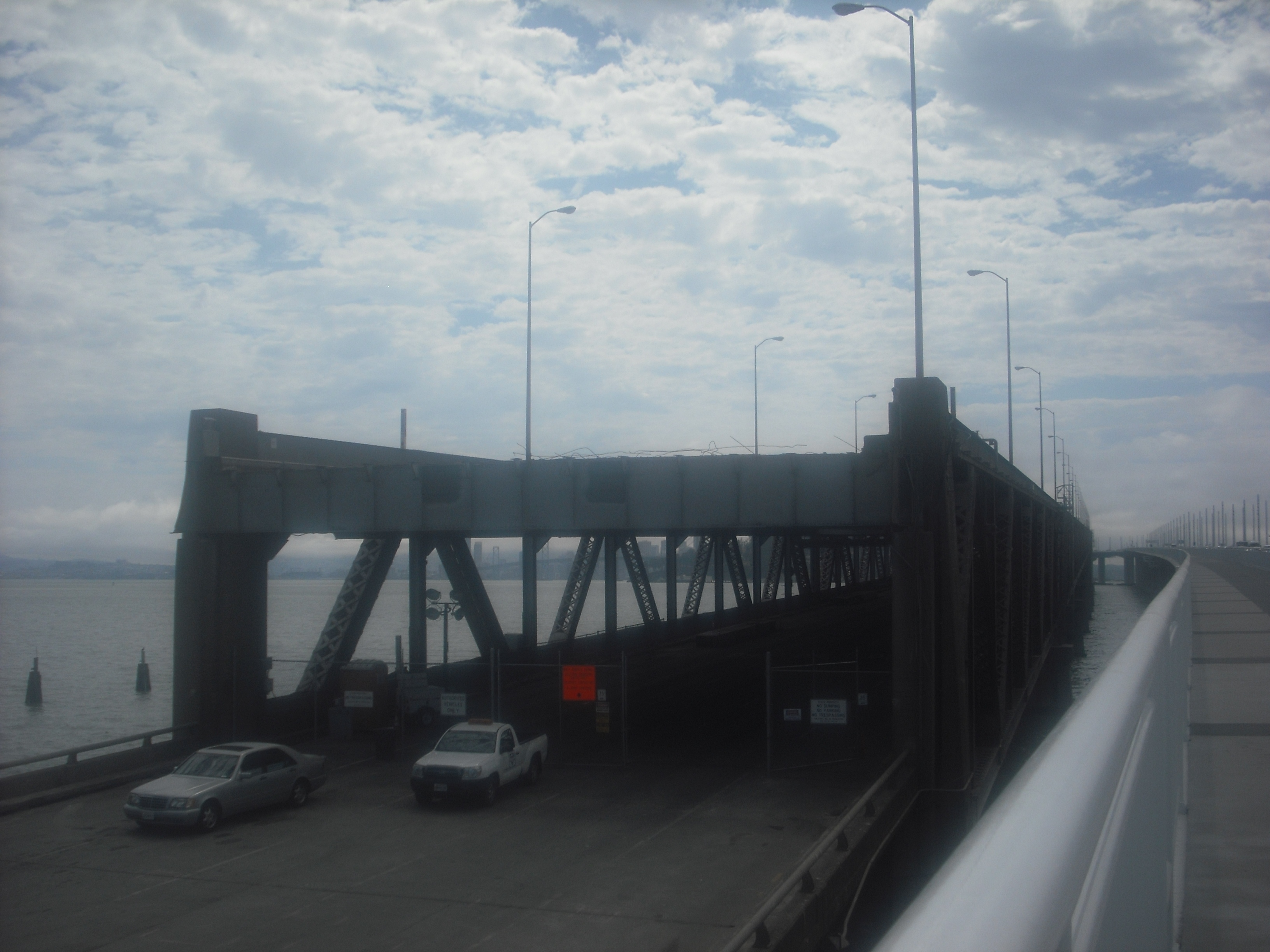
A bridge with no entrance and, on the day we saw it, no people.
The biggest frustration, of course, is that you can’t ride all the way across the bridge to San Francisco (or even ride anywhere on the bridge from San Francisco). Imagine if you could only ride or walk halfway across the Golden Gate Bridge. Of course, the Bay Bridge is much, much longer than the Golden Gate Bridge — about four-and-a-half miles, where the GG Bridge is a little more than one-and-a-half miles. Funding for a west span path being so costly and subject to government/public policy debates, I’ll consider it a triumph if I’m able to bike the bridge from bay-to-bay in my lifetime.
You can’t, however, even bike to Yerba Buena Island, which would give you something of a destination, and theoretically enable you to continue to San Francisco by mounting your bicycle on the front of a public bus (though those only have racks for two bikes at a time). As of this writing, the path stops just a little short of the island.
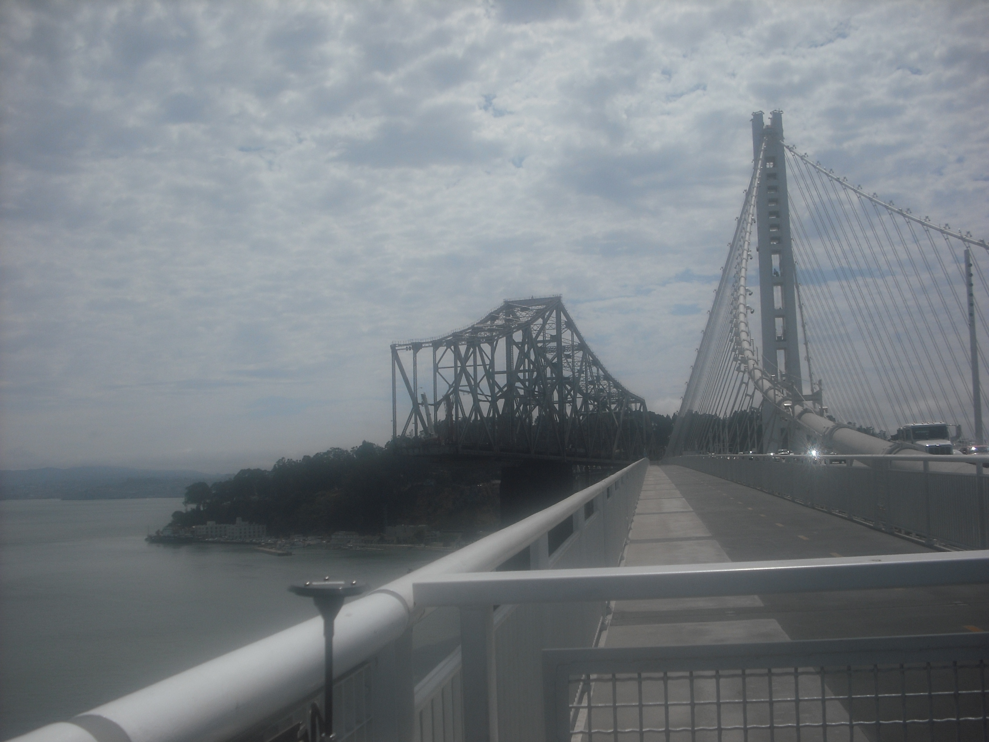
Yerba Buena Island (in the background) isn’t too far from where the bike path ends.
Though it seems not much more than a stone’s throw away, again funding/policy issues might be a lot more costly and complicated than you’d think. For one thing, a remaining portion of the original bridge has to be dismantled before the path can even reach the island. It was reported that the path should connect to Yerba Buena Island a couple years after the east span opened, which would have made it open for business by the end of 2015, but no definite ETA seems available at the moment.
For San Franciscans, it’s an odd experience, taking the BART train to the East Bay, riding from there to the middle of the bay, and riding back to a BART station to take a train back to San Francisco. That makes it a bit more than a casual getaway, but it’s worth doing, once or twice a year at any rate. It’s a bit of a slog to ride the windy uphill section to its current endpoint, but be consoled by the knowledge, as one rider shouted to us on our way up, that it’s all downhill once you turn around. As long as you’re going, though, try to check out other sights on the path that runs from Emeryville to Richmond, like the Berkeley Marina:
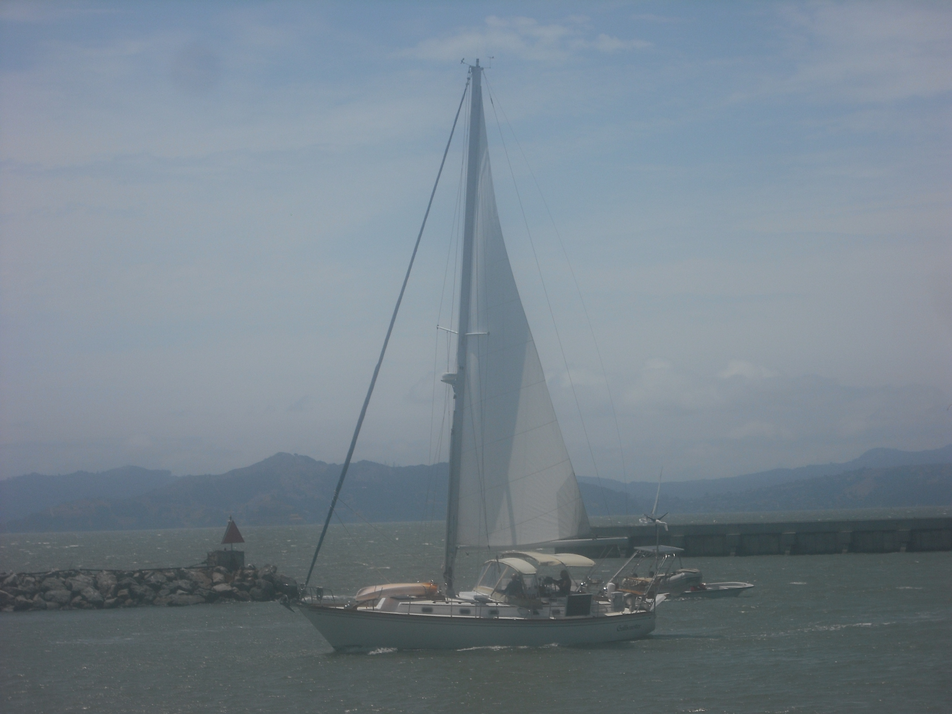
Sailors just off the Berkeley Marina.
The Bay Bridge bike/pedestrian path is generally open from around dawn to dusk, though hours change according to the season. Check the Bay Bridge Bicycle and Pedestiran Path site for specific opening/closing times, as well as general information about the path.
Thanks for this write up of your experiences on the Bay Bridge East Span bicycle/pedestrian path. As for the landing onto Yerba Buena Island, it is still on track to be completed in 2015, ideally by the summer. There is another planning process ongoing for the land vacated by the old bridge’s landing on the Oakland side, which will be developed into a large public space called Gateway Park (more info at http://www.baybridgegatewaypark.com), as well as an additional bikeway path connection into West Oakland alongside Grand Ave.
Plans for a similar path on the Bay Bridge West Span path are chugging along slowly, but in the meantime development on Treasure Island including a short-hop ferry to San Francisco is moving along. This will serve future island residents as well as people on bikes who could then bike halfway across the bay then take the ferry for the remainder.
More info on all of these projects can be accessed at BikeEastBay.org/BayBridge
Thanks for the additional info, Robert. We’ll look forward to being able to bike to Yerba Buena Island soon.